


Land Change Detection using Matlab Code
₹3,000.00
Huge Price Drop : 50% Discount
Source Code + Demo Video
100 in stock
Description
ABSTRACT
The project presents change detection approach for synthetic aperture radar (SAR) images based on an image fusion and supervised classifier system. The image fusion technique will be introduced to generate a difference image by using complementary information from a mean-ratio image and a log-ratio image. NSCT (Non- sub sampled contour let transform) fusion rules based on an average operator and minimum local area gradient are chosen to fuse the contour let coefficients for a low-frequency band and a high-frequency band, respectively to restrain the background information and enhance the information of changed regions in the fused difference image. For the remote sensing images, differencing (subtraction operator) and rationing (ratio operator) are well-known techniques for producing a difference image. In differencing, changes are measured by subtracting the intensity values pixel by pixel between the considered couple of temporal images. In rationing, changes are obtained by applying a pixel-by-pixel ratio operator to the considered couple of temporal images. In the case of SAR images, the ratio operator is typically used instead of the subtraction operator since the image differencing technique is not adapted to the statistics of SAR images. An artificial neural network type multi layer perception or back propagation with feed forward network will be proposed for classifying changed and unchanged regions in the fused difference image. This classifier comes under supervised segmentation which is worked based on training cum classification. The results will be proven that rationing generates better difference image for change detection using supervised classifier segmentation approach and efficiency of this algorithm will be exhibited by sensitivity and correlation evaluation.
EXISTING METHOD
- Averaging and Maximization methods based spatial level fusion
- Gray level Thresholding and Otsu segmentation
- K means clustering methods
DRAWBACKS
- Contrast information loss due to averaging method
- Maximization method sensitive to sensor noise and high spatial distortion
- K means – It is not suitable for all lighting condition of images
- Difficult to measure the cluster quality
PROPOSED METHOD
Multi temporal synthetic aperture radar image analysis for land cover change detection based on,
- NSCT based image fusion approach and Artificial neural network with feed forward back propagation model
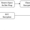
BLOCK DIAGRAM
CHANGE DETECTION

FUSION DESIGN MODEL

METHODOLOGIES
- Difference image detection with log-ratio and mean-ratio operator
- Fusion using NSCT
- Back propagation with feed forward network classifier
- Parameters Evaluation(Cluster efficiency, Sensitivity and Correlation)
ADVANTAGES
- Accurate detection of foreground changes by fusion
- Less sensitive to noises and less processing time.
APPLICATIONS
- Earth land changes detection in Satellite field
- Surveillance
SYSTEM REQUIREMENTS
- MATLAB 7.5 and above versions
- NSCT and Neural network toolboxes
RESULTS


REFERENCES
[1] M. K. Ridd and J. Liu, “A comparison of four algorithms for change detection in an urban environment,” Remote Sens. Environ., vol. 63, no. 2, pp. 95–100, Feb. 1998
[2] Francesca Bovolo, Lorenzo Bruzzone, “A Wavelet-Based Change Detection Technique for Multitemporal SAR Image,” IEEE International Geoscience and Remote Sensing Sympos, pp. 85-89, 2005
[3] HUANG Shiqi, LlU Daizhi, Hu Mingxing, “Multi-temporal SAR Image Change Detection Technique Based on Wavelet Transform,” Acta Geodaetica et Cartographica Sinica, Vo1.32, NO.2, pp.180-185, 2010.
[4] D. Brunner, G. Lemoine, and L. Bruzzone, “Earthquake damage assessment of buildings using VHR optical and SAR imagery,” IEEE Trans. Geosci. Remote Sens., vol. 48, no. 5, pp. 2403–2420, May 2010.
[5] E. Rignot and J. van Zyl, “Change detection techniques for ERS-1 SAR data,” IEEE Trans. Geosci Remote Sens., vol. 31, no. 4, pp. 896–906, Jul. 1993
Additional information
| Weight | 0.000000 kg |
|---|


Reviews
There are no reviews yet.