LIDAR Projects
LiDAR (Light Detection and Ranging ) is a remote sensing technology which uses the pulse from a laser to collect measurements . LiDAR works in a similar way to Radar and Sonar but uses light waves from a laser, instead of radio or sound waves .Lidar can be used for distance measurement ,to measure distance in 3d clouds.For lasee scanning of 3D Models,
Lidar Working Principle
- Emission of a laser pulse
- Record of the back scattered signal
- Distance measurement (Time of travel x speed of light)
- Retrieving plane position and altitude
- Computation of precise echo position
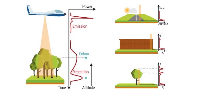
1. emitting a laser pulse on a surface
2. catching the reflected laser back to the LiDAR pulse source with sensors
3. measuring the time laser travelled
4. calculating the distance from source with the formula “Distance = (Speed of light x Time elapsed) / 2
This process is repeated a million times by LiDAR instruments and ends up by producing a complex map of the surveyed area : a 3D point cloud.
Applications of Lidar
- SLAM
- 3D Mapping
- Vehicle & Robot Automation for Self Navigation
List of Student Projects on Lidar
- Arduino Map generation using LIDAR
- Obstacle Avoidance
- SLAM Implementation using LIDAR and Matlab
- Path planning Robot using Lidar and Image Processing
- Self Driving Car using LIDAR and Image Processing